Triple Dyke coastal strategy, Shenzhen
Felixx Landscape Architects & Planners · Shenzhen - China
Category Winner 2026
Overview
Triple Dyke coastal strategy, Shenzhen Typhoon-Proof Shenzhen's East Coast
After severe typhoon damage exposed the limits of hard coastal defenses, Shenzhen set out to rethink how its 130 km long coastline protects people, nature, and daily life. Together with local and international partners, Felixx developed a signature triple dyke coastal strategy that responds with resilience while keeping the coast open, usable, and alive.
Typhoon-proofing 130 KMs of coastline Shenzhen's east coast is not a single coastline. It's a 130km territorial system where four forces converge: typhoon exposure and storm surge, a continuous ecological gradient from mountain to sea, intense recreational and tourism pressure from one of Asia's largest metropolitan regions, and fishing villages navigating a profound socio-economic transition. After Typhoon Mangkhut laid bare the fragility of the existing defences in 2018, Shenzhen's challenge became clear: not to build higher, but to reorganise how the entire coastal system functions.
Felixx developed the triple dyke strategy as the spatial framework to do exactly that, weaving safety, ecology, urban development, and cultural continuity into one adaptive system that keeps the coastline open, productive, and alive. By working with natural systems rather than against them, the triple dyke reduces the need for hard infrastructure.
The Triple Dyke Strategy The triple dyke strategy forms the spatial backbone of Shenzhen’s coastline, transforming the seawall from a uniform line into an adaptive, context-driven coastal zone. This methodology dynamically responds to shifting local conditions along the entire coastline. Rather than separating land and sea, the system mediates between them through three interrelated layers. Closest to the water, the outer zone reduces wave energy and supports natural processes such as sedimentation and ecological growth. The middle zone integrates the primary seawall with public space, designed to withstand storm surge, wave action, and sea level rise while remaining part of daily coastal life. The inner zone manages rainwater runoff from the mountains, rainfall, and overtopping through a network of landscapes that store, filter, and delay water.
Together, these layers operate as one system that aligns safety, ecology, and use across different conditions and time scales, creating a coastline that is resilient, adaptable, and open.
A process led by nature, shaped locally The triple dyke strategy was informed by observing how mountains, streams, beaches, villages, and rocky headlands meet the sea – and behave differently during storms. Felixx partnered with KCAP and Deltares to study how water, wind, waves, and sediment move along the coast during typhoons and heavy rainfall. The strategy does not result in a single design, but in a spectrum of spatial responses along the coastline.
Three interrelated layers The system is built up of three connected zones: an outer natural defence, a multifunctional middle layer, and an inner system for water management.
Outer zone: working with natural forces Closest to the sea, the outer zone strengthens coastal landscapes such as mangroves, beaches, and rocky shorelines. It reduces wave energy and supports sedimentation and biodiversity as the first line of defence.
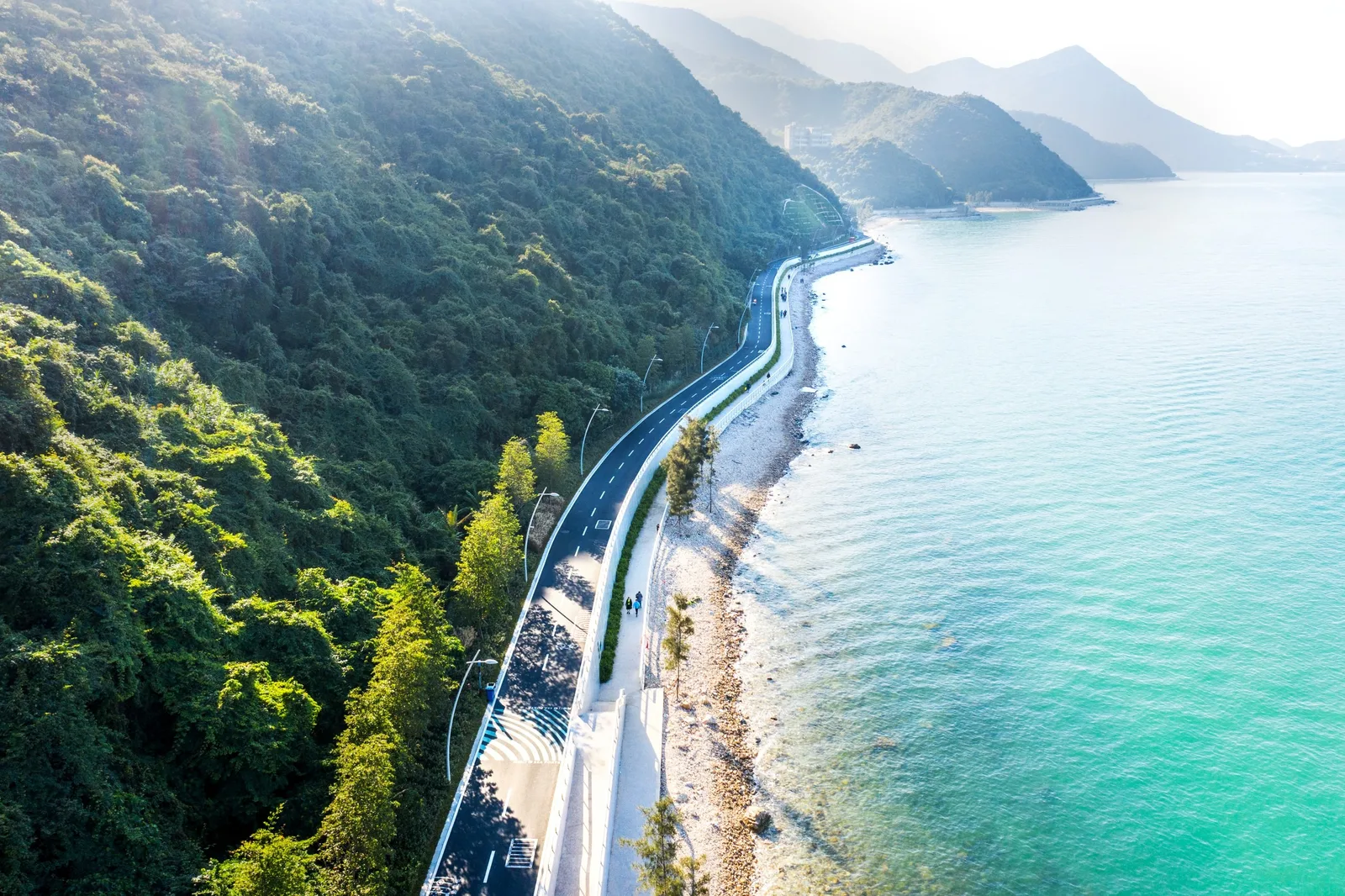
Middle zone: protection and public space The middle zone forms the primary seawall, designed as an elevated public landscape. It integrates promenades, squares, and local activities, while being dimensioned to withstand storm surge, wave action, and sea level rise.
Inner zone: capturing and storing water In areas where water flows down from the hills, the inner zone becomes a buffer that captures, slows, and infiltrates rainwater. In more urban or accessible locations, the inner zone is higher to provide safety during extreme events while remaining part of everyday coastal life.
The triple dyke is a system designed to grow. Each completed stretch delivers immediate protection and opens the coast to daily use. Over time, mangroves establish, rain gardens mature, and sediment stabilises.
Real-world test site: Yangmeikeng Sea Boulevard Triple Dyke coastal strategy produces a spectrum of coastlines—from engineered and urban, to hybrid, to largely natural. Yangmeikeng Sea Boulevard was the first stretch to be realised, serving as a full-scale test site for the broader coastal strategy. Rather than moving directly into large-scale implementation, the project team used this section to develop, test, and refine key design principles in collaboration with local engineers, contractors, and the client. The pilot provided valuable insights into how technical performance, construction feasibility, and spatial quality could be combined within a single design approach. By translating these lessons into a repeatable framework, Yangmeikeng became both a built project and a prototype—reducing uncertainty and creating a practical foundation for the implementation of the larger coastal protection system.
- Website
- felixx.nl
- Location
- Shenzhen - China
- Edition
- 2026
- Discipline
- Landscape Design
- Category
- Public Space
Project credits
- Lead Designer
- Felixx Landscape Architects & Planners
- Team
- Felixx Landscape Architects & Planners, KCAP, Deltares, Hope Landscape & Architecture, China Water Transport Planning & Design
- Photography
- DUO Architectural Photography Hongduo Zhuo, Felixx Landscape Architects & Planners